Current Epoch: Epoch 10
Start: 16 Dec 2021 (Day 350) 14:27:41 | End: Present
Active Release: R05
R04 products will be available until all R05 products have been released.
2C-SNOW-PROFILE
Product Availability: Full mission availability except for anomalies and maneuver data gaps
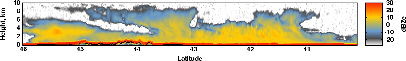
The CloudSat Snow Profile product (2C-SNOW-PROFILE) provides estimates of vertical profiles of snowfall rate along with snow size distribution parameters and snow water content for radar reflectivity profiles observed by the CloudSat Cloud Profiling Radar (CPR) which, based on an evaluation of the profile and ancillary data, appear to coincide with snow at the surface. For these profiles, the product also estimates snowfall rate at the surface. Because of ground clutter, the CPR cannot reliably measure reflectivities near the surface. To overcome this limitation, the product algorithm estimates snow properties using a truncated reflectivity profile, terminated somewhat above the surface, then uses the estimated snow properties in the bottom-most portion of the profile to estimate the surface snowfall rate. For the truncated reflectivity profile, profiles of size distribution parameters are retrieved using an optimal estimation algorithm which incorporates a priori information about snow microphysical properties, radar scattering properties, and size distribution parameters. Retrievals are performed only for profiles which appear likely to contain snow at the surface, either dry snow or snow with a small melted mass fraction. The retrieved size distribution parameter profiles and the a priori information are then used to calculate profiles of snowfall rates and snow water contents. The optimal estimation method produces uncertainty estimates for the retrieved size distribution parameters, and these uncertainties are then used to estimate uncertainties for the snowfall rates and snow water contents.
Primary Publication(s)
Wood, N. B., T. S. L'Ecuyer, A. J. Heymsfield, G. L. Stephens, D. R. Hudak, and P. Rodrigues, 2014: Estimating snow microphysical properties using collocated multisensor observations. J. Geophys. Res. Atmos., 119, 8941-8961, doi:10.1002/2013JD021303.
Wood, N. B., T. S. L'Ecuyer, F. L. Bliven, and G. L. Stephens, 2013: Characterization of video disdrometer uncertainties and impacts on estimates of snowfall rate and radar reflectivity, Atmos. Meas. Tech., 6, 3635-3648, doi:10.5194/amt-6-3635-2013.
Process Description and Interface Control Document (PDICD)
2C-SNOW-PROFILE P1_R05 PDICD (Rev. 0) (Updated May 1, 2018)E09 Data Issues (Updated January 30, 2023)
Process Description and Interface Control Document (PDICD)
2C-SNOW-PROFILE P_R04 PDICD (Updated February 10, 2013)Algorithm Specifications (for latest R05)
Geolocation Fields
| Field | Type | Dimensions | Units | Valid Range | Missing | Missing Op. | Factor | Offset |
|---|---|---|---|---|---|---|---|---|
| Profile_time | FLOAT32 | nray | seconds | [0.0, 6000.0] | 1.0 | 0.0 | ||
| UTC_start | FLOAT32 | scalar | seconds | [0.0, 86400.0] | 1.0 | 0.0 | ||
| TAI_start | FLOAT64 | scalar | seconds | [0.0, 600000000.0] | 1.0 | 0.0 | ||
| Latitude | FLOAT32 | nray | degrees | [-90.0, 90.0] | 1.0 | 0.0 | ||
| Longitude | FLOAT32 | nray | degrees | [-180.0, 180.0] | 1.0 | 0.0 | ||
| Height | INT16 | nray,nbin | m | [-5000.0, 30000] | -9999 | == | 1.0 | 0.0 |
| DEM_elevation | INT16 | nray | meters | [-9999.0, 8850] | 9999 | == | 1.0 | 0.0 |
| Vertical_binsize | FLOAT32 | scalar | m | -9999.0 | == | 1.0 | 0.0 |
Data Fields
| Field | Type | Dimensions | Units | Valid Range | Missing | Missing Op. | Factor | Offset |
|---|---|---|---|---|---|---|---|---|
| Data_quality | UINT8 | nray | -- | [0, 255] | 1.0 | 0.0 | ||
| Data_status | UINT16 | nray | -- | [0, 65535] | 1.0 | 0.0 | ||
| Data_targetID | UINT8 | nray | -- | [0, 255] | 1.0 | 0.0 | ||
| RayStatus_validity | UINT8 | nray | -- | [0, 255] | 1.0 | 0.0 | ||
| Navigation_land_sea_flag | UINT8 | nray | -- | [1, 4] | 1.0 | 0.0 | ||
| snow_retrieval_status | INT8 | nray | -- | [-128.0, 127] | 0 | == | 1.0 | 0.0 |
| norm_chi_square | FLOAT32 | nray | -- | [0.0, 10.0] | -999.0 | 1.0 | 0.0 | |
| snowfall_rate | FLOAT32 | nray,nbin | mm/h | [0.0, 40.0] | -999.0 | == | 1.0 | 0.0 |
| snowfall_rate_uncert | FLOAT32 | nray,nbin | mm/h | [0.0, 120.0] | -999.0 | == | 1.0 | 0.0 |
| log_N0 | FLOAT32 | nray,nbin | -- | [2.0, 8.0] | -999.0 | == | 1.0 | 0.0 |
| log_N0_uncert | FLOAT32 | nray,nbin | -- | [1.0, 2.0] | -999.0 | == | 1.0 | 0.0 |
| log_lambda | FLOAT32 | nray,nbin | -- | [-1.0, 2.0] | -999.0 | == | 1.0 | 0.0 |
| log_lambda_uncert | FLOAT32 | nray,nbin | -- | [0.0, 1.0] | -999.0 | == | 1.0 | 0.0 |
| snowfall_rate_sfc | FLOAT32 | nray | mm/h | [0.0, 40.0] | -999.0 | == | 1.0 | 0.0 |
| snowfall_rate_sfc_uncert | FLOAT32 | nray | mm/h | [0.0, 120.0] | -999.0 | == | 1.0 | 0.0 |
| snowfall_rate_sfc_confidence | INT8 | nray | -- | [-1.0, 4] | -1 | == | 1.0 | 0.0 |
| snow_water_content | FLOAT32 | nray,nbin | g/m^3 | [0.0, 5.0] | -999.0 | == | 1.0 | 0.0 |
| snow_water_content_uncert | FLOAT32 | nray,nbin | g/m^3 | [0.0, 15.0] | -999.0 | == | 1.0 | 0.0 |
| snow_top_height_bin | INT8 | nray | -- | [1, 125] | -99 | == | 1.0 | 0.0 |