Current Epoch: Epoch 10
Start: 16 Dec 2021 (Day 350) 14:27:41 | End: Present
Active Release: R05
R04 products will be available until all R05 products have been released.
MODIS-AUX
Product Availability: Available during A-Train Epochs except for anomalies and maneuver data gaps
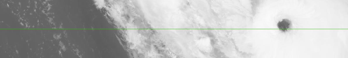
The MODIS-AUX data set is an intermediate product that contains a subset of ancillary MODIS radiance and cloud mask data that overlaps and surrounds each CloudSat cloud profiling radar (CPR) footprint. Input data are obtained from the 1B-CPR and AN-MODIS products, and the MODIS-AUX data are used as input to the 2B-GEOPROF, 2B-CLDCLASS, 2B-TAU, and 2B-FLXHR algorithms in the CloudSat data processing system. The MODIS-AUX product is created by the Generic-AUX Subset-to-Reference algorithm.
Primary Publication(s)
No publications found.
Process Description and Interface Control Document (PDICD)
E09 Data Issues (Updated July 17, 2023)MODIS-AUX P_R05 PDICD (Rev. 1) (Updated November 8, 2017)
Process Description and Interface Control Document (PDICD)
MODIS-AUX P_R04 PDICD (Updated July 18, 2007)Algorithm Specifications (for latest R05)
Geolocation Fields
| Field | Type | Dimensions | Units | Valid Range | Missing | Missing Op. | Factor | Offset |
|---|---|---|---|---|---|---|---|---|
| MODIS_latitude | FLOAT32 | nray,mod_1km | [-90.0, 90.0] | -999.0 | eq | |||
| MODIS_longitude | FLOAT32 | nray,mod_1km | [-180.0, 180.0] | -999.0 | eq | |||
| Profile_time | FLOAT32 | nray | seconds | [0.0, 6000.0] | 1.0 | 0.0 | ||
| UTC_start | FLOAT32 | scalar | seconds | [0.0, 86400.0] | 1.0 | 0.0 | ||
| TAI_start | FLOAT64 | scalar | seconds | [0.0, 600000000.0] | 1.0 | 0.0 |
Data Fields
| Field | Type | Dimensions | Units | Valid Range | Missing | Missing Op. | Factor | Offset |
|---|---|---|---|---|---|---|---|---|
| MODIS_granule_index | INT8 | nray,mod_1km | [1, 25] | -99 | == | |||
| MODIS_pixel_index_along_track | INT16 | nray,mod_1km | [1, 2030] | -999 | == | |||
| MODIS_pixel_index_across_track | INT16 | nray,mod_1km | [1, 1354] | -999 | == | |||
| Solar_zenith | INT16 | nray,mod_1km | [0, 18000] | -32767 | eq | |||
| Solar_azimuth | INT16 | nray,mod_1km | [-18000.0, 18000] | -32767 | eq | |||
| Sensor_zenith | INT16 | nray,mod_1km | [0, 18000] | -32767 | eq | |||
| Sensor_azimuth | INT16 | nray,mod_1km | [-18000.0, 18000] | -32767 | eq | |||
| Cloud_Mask | INT8 | Byte_Segment,nray,mod_1km | [0, 1] | 0 | eq | |||
| EV_1KM_RefSB | UINT16 | Band_1KM_RefSB,nray,mod_1km | [0, 32767] | 32768 | ge | |||
| EV_1KM_RefSB_ref_offsets | FLOAT32 | Band_1KM_RefSB,mod_granules | -999.0 | eq | ||||
| EV_1KM_RefSB_ref_scales | FLOAT32 | Band_1KM_RefSB,mod_granules | -999.0 | eq | ||||
| EV_1KM_RefSB_rad_offsets | FLOAT32 | Band_1KM_RefSB,mod_granules | -999.0 | eq | ||||
| EV_1KM_RefSB_rad_scales | FLOAT32 | Band_1KM_RefSB,mod_granules | -999.0 | eq | ||||
| EV_1KM_RefSB_Uncert_Indexes | UINT8 | Band_1KM_RefSB,nray,mod_1km | [0, 15] | 255 | eq | |||
| EV_1KM_RefSB_scaling_factor | FLOAT32 | Band_1KM_RefSB,mod_granules | -999.0 | eq | ||||
| EV_1KM_RefSB_spec_uncert | FLOAT32 | Band_1KM_RefSB,mod_granules | -999.0 | eq | ||||
| EV_1KM_Emissive | UINT16 | Band_1KM_Emissive,nray,mod_1km | [0, 32767] | 32768 | ge | |||
| EV_1KM_Emissive_rad_offsets | FLOAT32 | Band_1KM_Emissive,mod_granules | -999.0 | eq | ||||
| EV_1KM_Emissive_rad_scales | FLOAT32 | Band_1KM_Emissive,mod_granules | -999.0 | eq | ||||
| EV_1KM_Emissive_Uncert_Indexes | UINT8 | Band_1KM_Emissive,nray,mod_1km | [0, 15] | 255 | ge | |||
| EV_1KM_Emissive_scaling_factor | FLOAT32 | Band_1KM_Emissive,mod_granules | -999.0 | eq | ||||
| EV_1KM_Emissive_spec_uncert | FLOAT32 | Band_1KM_Emissive,mod_granules | -999.0 | eq | ||||
| EV_250_RefSB | UINT16 | Band_250M,nray,mod_1km | [0, 32767] | 32768 | ge | |||
| EV_250_RefSB_ref_offsets | FLOAT32 | Band_250M,mod_granules | -999.0 | eq | ||||
| EV_250_RefSB_ref_scales | FLOAT32 | Band_250M,mod_granules | -999.0 | eq | ||||
| EV_250_RefSB_rad_offsets | FLOAT32 | Band_250M,mod_granules | -999.0 | eq | ||||
| EV_250_RefSB_rad_scales | FLOAT32 | Band_250M,mod_granules | -999.0 | eq | ||||
| EV_250_RefSB_Uncert_Indexes | UINT8 | Band_250M,nray,mod_1km | [0, 15] | 255 | eq | |||
| EV_250_RefSB_scaling_factor | FLOAT32 | Band_250M,mod_granules | -999.0 | eq | ||||
| EV_250_RefSB_spec_uncert | FLOAT32 | Band_250M,mod_granules | -999.0 | eq | ||||
| EV_500_RefSB | UINT16 | Band_500M,nray,mod_1km | [0, 32767] | 32768 | ge | |||
| EV_500_RefSB_ref_offsets | FLOAT32 | Band_500M,mod_granules | -999.0 | eq | ||||
| EV_500_RefSB_ref_scales | FLOAT32 | Band_500M,mod_granules | -999.0 | eq | ||||
| EV_500_RefSB_rad_offsets | FLOAT32 | Band_500M,mod_granules | -999.0 | eq | ||||
| EV_500_RefSB_rad_scales | FLOAT32 | Band_500M,mod_granules | -999.0 | eq | ||||
| EV_500_RefSB_Uncert_Indexes | UINT8 | Band_500M,nray,mod_1km | [0, 15] | 255 | eq | |||
| EV_500_RefSB_scaling_factor | FLOAT32 | Band_500M,mod_granules | -999.0 | eq | ||||
| EV_500_RefSB_spec_uncert | FLOAT32 | Band_500M,mod_granules | -999.0 | eq |