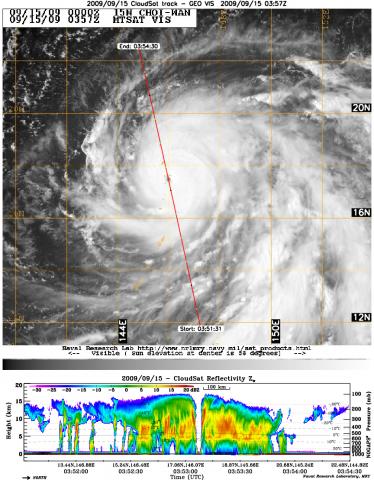
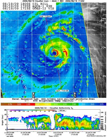
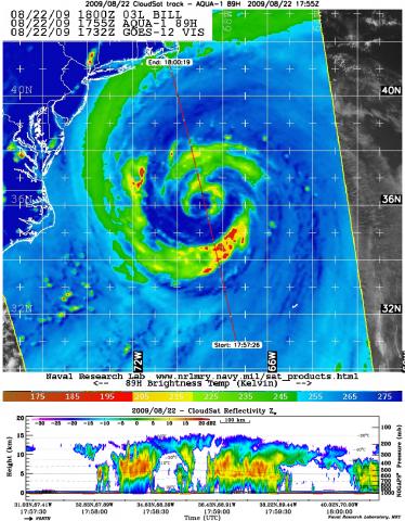
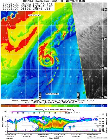
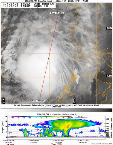
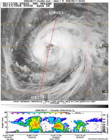
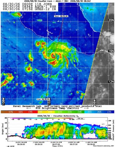
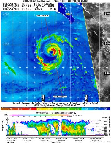
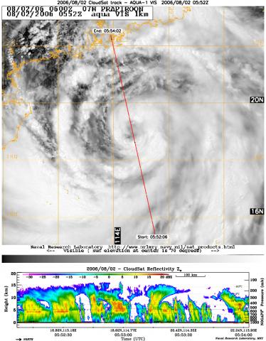
CloudSat Tropical Cyclone Product (2D-TC)
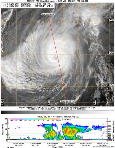
The CloudSat Tropical Cyclone Product (2D-TC) is a compilation of CloudSat cloud profiling radar (CPR) overpasses of Tropical Cyclones (TC’s) from each basin (Atlantic, East Pacific, Central Pacific, West Pacific, Southern Hemisphere and Indian Ocean) within 1000 km of the TC center. Each TC overpass contains TC center latitude, longitude, minimum distance from TC center, estimated maximum wind speed, estimated minimum sea level pressure, sea surface temperature and wind shear at varying levels in the atmosphere. Additional CloudSat level 2B, level 2C, level AUX and Year of Tropical Convection (YOTC) products are subsetted to the time of each TC overpass.
Primary Publication
Tourville, N., G. Stephens, M. DeMaria, D. Vane, 2014: Remote Sensing of Tropical Cyclones: Observations from CloudSat and A-Train Profilers, Bull. Amer. Meteor. Soc., 96, 609–622.Product Image Examples